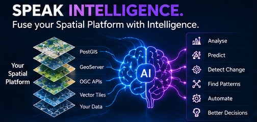
SPATIAL AI
Speak intelligence.
Fuse spatial platforms with artificial intelligence to turn geospatial data into intelligent systems.
What we do
Spatial AI brings together geospatial data, spatial analysis and machine learning to support systems that can understand, classify, predict and reason about spatial information.
CordOps focuses on practical applications where AI can add value to existing geospatial workflows and platforms.
Capabilities
Spatial Data
Preparation and organisation of geospatial datasets for AI workflows.
Computer Vision
Machine-learning workflows for imagery and spatial visual data.
Spatial Analysis
Combining spatial operations with machine-learning models and inference.
Intelligent Systems
Connecting AI models with existing spatial platforms and applications.
Potential applications
- Satellite and aerial imagery analysis
- Land-use and land-cover classification
- Object detection from spatial imagery
- Spatial pattern analysis
- Geospatial feature extraction
- AI-assisted spatial workflows
Our approach
Spatial AI projects begin with the spatial problem rather than the AI model. We first understand the data, workflow and expected outcome before determining where machine learning can provide value.
The resulting system can combine spatial databases, geospatial processing, machine-learning models and web-based interfaces where required.
Have a spatial problem?
Let's explore where spatial intelligence can fit into your workflow.
Get in touch