CUSTOM SOLUTIONS
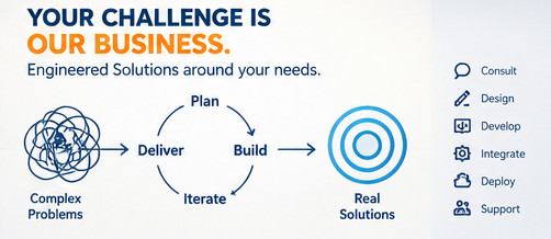
Your challenge is our business.
Engineered solutions around your specific geospatial, data and technology requirements.
What we do
Not every geospatial problem fits neatly into an existing product or workflow. Sometimes the right solution requires combining several technologies into a system designed specifically for the task.
CordOps works across geospatial data, databases, APIs, WebGIS and automation to build practical solutions around specific requirements.
Capabilities
Geospatial Applications
Custom applications built around spatial data and operational workflows.
Data Engineering
Automated pipelines for processing, transforming and managing spatial data.
APIs & Integration
Connect spatial databases, services, applications and external systems.
Automation
Replace repetitive manual processes with reliable, repeatable workflows.
Where we can help
- Custom geospatial data pipelines
- Spatial data processing automation
- Internal GIS tools
- Spatial APIs and integrations
- Geospatial workflow automation
- Custom mapping and data interfaces
- Integration of existing geospatial systems
Our approach
We start with the problem rather than prescribing a technology. The existing systems, data, constraints and desired outcome are considered before designing the solution.
The result is a focused system built around the actual requirement, using established technologies wherever they provide the right foundation.